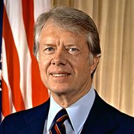
Carter297
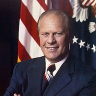
Ford240
1976 electoral votes. Popular vote: Carter 50.0%, Ford 48.0%, others 2.0%.
Faithless electors: Ronald Reagan 1 (Washington).
Electoral votes by state
By state
| State | EV | Won by | Carter % | Ford % | Others % | Margin, all votes | Margin, two-party | Votes |
|---|---|---|---|---|---|---|---|---|
| Alabama | 9 | D 9 | 55.7 | 42.6 | 1.7 | D+13.1 | D+13.3 | 1,182,850 |
| Alaska | 3 | R 3 | 35.7 | 57.9 | 6.4 | R+22.3 | R+23.8 | 123,574 |
| Arizona | 6 | R 6 | 39.8 | 56.4 | 3.8 | R+16.6 | R+17.2 | 742,719 |
| Arkansas | 6 | D 6 | 65.0 | 34.9 | 0.1 | D+30.1 | D+30.1 | 767,535 |
| California | 45 | R 45 | 48.0 | 49.7 | 2.3 | R+1.8 | R+1.8 | 7,803,770 |
| Colorado | 7 | R 7 | 42.6 | 54.0 | 3.4 | R+11.4 | R+11.8 | 1,081,440 |
| Connecticut | 8 | R 8 | 46.7 | 51.9 | 1.4 | R+5.1 | R+5.2 | 1,386,355 |
| Delaware | 3 | D 3 | 52.0 | 46.6 | 1.4 | D+5.4 | D+5.5 | 235,642 |
| District of Columbia | 3 | D 3 | 81.6 | 16.5 | 1.9 | D+65.1 | D+66.4 | 168,830 |
| Florida | 17 | D 17 | 51.9 | 46.6 | 1.4 | D+5.3 | D+5.4 | 3,150,631 |
| Georgia | 12 | D 12 | 66.9 | 33.1 | 0.0 | D+33.9 | D+33.9 | 1,463,152 |
| Hawaii | 4 | D 4 | 50.6 | 48.1 | 1.3 | D+2.5 | D+2.6 | 291,301 |
| Idaho | 4 | R 4 | 37.1 | 59.9 | 3.0 | R+22.8 | R+23.5 | 340,932 |
| Illinois | 26 | R 26 | 48.1 | 50.1 | 1.8 | R+2.0 | R+2.0 | 4,721,282 |
| Indiana | 13 | R 13 | 45.7 | 53.3 | 1.0 | R+7.6 | R+7.7 | 2,220,362 |
| Iowa | 8 | R 8 | 48.5 | 49.5 | 2.1 | R+1.0 | R+1.0 | 1,279,303 |
| Kansas | 7 | R 7 | 44.9 | 52.5 | 2.6 | R+7.6 | R+7.8 | 957,845 |
| Kentucky | 9 | D 9 | 52.8 | 45.6 | 1.7 | D+7.2 | D+7.3 | 1,167,142 |
| Louisiana | 10 | D 10 | 51.8 | 46.0 | 2.2 | D+5.8 | D+5.9 | 1,277,383 |
| Maine | 4 | R 4 | 48.1 | 48.9 | 3.0 | R+0.8 | R+0.9 | 482,968 |
| Maryland | 10 | D 10 | 53.0 | 47.0 | 0.0 | D+6.1 | D+6.1 | 1,432,273 |
| Massachusetts | 14 | D 14 | 56.1 | 40.4 | 3.4 | D+15.7 | D+16.2 | 2,547,558 |
| Michigan | 21 | R 21 | 46.5 | 51.9 | 1.7 | R+5.4 | R+5.5 | 3,651,590 |
| Minnesota | 10 | D 10 | 54.9 | 42.0 | 3.1 | D+12.9 | D+13.3 | 1,949,931 |
| Mississippi | 7 | D 7 | 49.6 | 47.7 | 2.6 | D+1.9 | D+1.9 | 768,390 |
| Missouri | 12 | D 12 | 51.1 | 47.5 | 1.4 | D+3.6 | D+3.7 | 1,953,600 |
| Montana | 4 | R 4 | 45.4 | 52.8 | 1.8 | R+7.4 | R+7.6 | 328,734 |
| Nebraska | 5 | R 5 | 38.4 | 59.2 | 2.3 | R+20.8 | R+21.3 | 606,749 |
| Nevada | 3 | R 3 | 45.8 | 50.2 | 4.0 | R+4.4 | R+4.5 | 201,876 |
| New Hampshire | 4 | R 4 | 43.5 | 54.7 | 1.8 | R+11.3 | R+11.5 | 339,627 |
| New Jersey | 17 | R 17 | 47.9 | 50.1 | 2.0 | R+2.2 | R+2.2 | 3,014,472 |
| New Mexico | 4 | R 4 | 48.3 | 50.7 | 1.0 | R+2.5 | R+2.5 | 416,590 |
| New York | 41 | D 41 | 50.8 | 46.5 | 2.7 | D+4.3 | D+4.4 | 6,668,262 |
| North Carolina | 13 | D 13 | 55.3 | 44.2 | 0.5 | D+11.0 | D+11.1 | 1,677,906 |
| North Dakota | 3 | R 3 | 45.8 | 51.7 | 2.5 | R+5.9 | R+6.1 | 297,308 |
| Ohio | 25 | D 25 | 48.9 | 48.7 | 2.4 | D+0.2 | D+0.2 | 4,110,456 |
| Oklahoma | 8 | R 8 | 48.7 | 50.0 | 1.3 | R+1.2 | R+1.2 | 1,092,251 |
| Oregon | 6 | R 6 | 47.6 | 47.8 | 4.6 | R+0.2 | R+0.2 | 1,029,876 |
| Pennsylvania | 27 | D 27 | 50.4 | 47.7 | 1.9 | D+2.7 | D+2.7 | 4,620,787 |
| Rhode Island | 4 | D 4 | 55.4 | 44.1 | 0.4 | D+11.3 | D+11.3 | 410,584 |
| South Carolina | 8 | D 8 | 56.2 | 43.1 | 0.7 | D+13.0 | D+13.1 | 802,583 |
| South Dakota | 4 | R 4 | 48.9 | 50.4 | 0.7 | R+1.5 | R+1.5 | 300,678 |
| Tennessee | 10 | D 10 | 55.9 | 42.9 | 1.1 | D+13.0 | D+13.1 | 1,476,346 |
| Texas | 26 | D 26 | 51.1 | 48.0 | 0.9 | D+3.2 | D+3.2 | 4,071,884 |
| Utah | 4 | R 4 | 33.6 | 62.4 | 3.9 | R+28.8 | R+30.0 | 541,218 |
| Vermont | 3 | R 3 | 42.3 | 54.6 | 3.1 | R+12.3 | R+12.7 | 183,902 |
| Virginia | 12 | R 12 | 48.0 | 49.3 | 2.7 | R+1.3 | R+1.4 | 1,697,094 |
| Washington | 9 | R 8, other 1 | 46.1 | 50.0 | 3.9 | R+3.9 | R+4.0 | 1,555,534 |
| West Virginia | 6 | D 6 | 58.1 | 41.9 | 0.0 | D+16.1 | D+16.1 | 750,590 |
| Wisconsin | 11 | D 11 | 49.5 | 47.8 | 2.7 | D+1.7 | D+1.7 | 2,101,336 |
| Wyoming | 3 | R 3 | 39.8 | 59.3 | 0.9 | R+19.5 | R+19.7 | 156,343 |
| United States | 538 | D 297, R 240, other 1 | 50.0 | 48.0 | 2.0 | D+2.1 | D+2.1 | 81,601,344 |
MEDSL and VEST results files and National Archives electoral votes: fixed historic releases.
Sources
- National Archives, Office of the Federal Register: Electoral College results 1976-2024 (Public domain (US government work))
- MIT Election Data and Science Lab, U.S. President 1976-2024, Harvard Dataverse (CC0 1.0)
- MIT Election Data and Science Lab, County Presidential Election Returns 2000-2016 (GitHub copy, commit f44e3fc; the dataset is CC0 1.0 on Harvard Dataverse, doi:10.7910/DVN/VOQCHQ) (CC0 1.0)
- Connecticut Secretary of the State, 2012 presidential election results by town (CT Election History), summed to the eight legacy counties by PollCheck (Official public records)
- Voting and Election Science Team, 2020 Precinct-Level Election Results, Harvard Dataverse (precincts summed to counties by PollCheck) (CC BY 4.0)
- PollCheck 2024 county totals (us_site/house_pres.py): MEDSL 2024 precinct returns (CC0 1.0) plus the state sources named in county_pres_2024.json (CC0 1.0 (MEDSL rows))
- US Census Bureau cartographic boundary files: counties 2020 (1:500,000) and 2024 (1:5,000,000) (Public domain)
- US Census Bureau state legislative districts (lower chamber), Alaska: TIGER/Line 2010 (2000 and 2010 districts) and cartographic boundary files 2013, 2018 and 2023 (Public domain)
- Maine Bureau of Corporations, Elections and Commissions, 2024 General Election, President and Vice President (certified, corrected 5 Dec 2024) (Maine government record)
- New York State Board of Elections, 2004 General Election, President and Vice President, results by county (New York government record)
- New York State Board of Elections, President and Vice-President Election Returns Nov. 6, 2012 (dated 20 Mar 2013, Kings update 9 Jun 2013), copy hosted by the American Presidency Project (New York government record)
- MIT Election Data and Science Lab, U.S. Senate statewide 1976-2024, Harvard Dataverse (CC0 1.0)
- State election office counts as read by the PollCheck midterms results feed (us_midterms_2026/data/results.json); uncertified (Official public records)
- us-atlas 3.0.1 counties-albers-10m (Census 2017 county boundaries) (ISC)
- us-atlas 3.0.1 states-albers-10m.json (US Census Bureau cartographic boundary files 2017; ISC licence)
- Photos: official portraits, public domain (US government); see Photo credits.
Final results.